

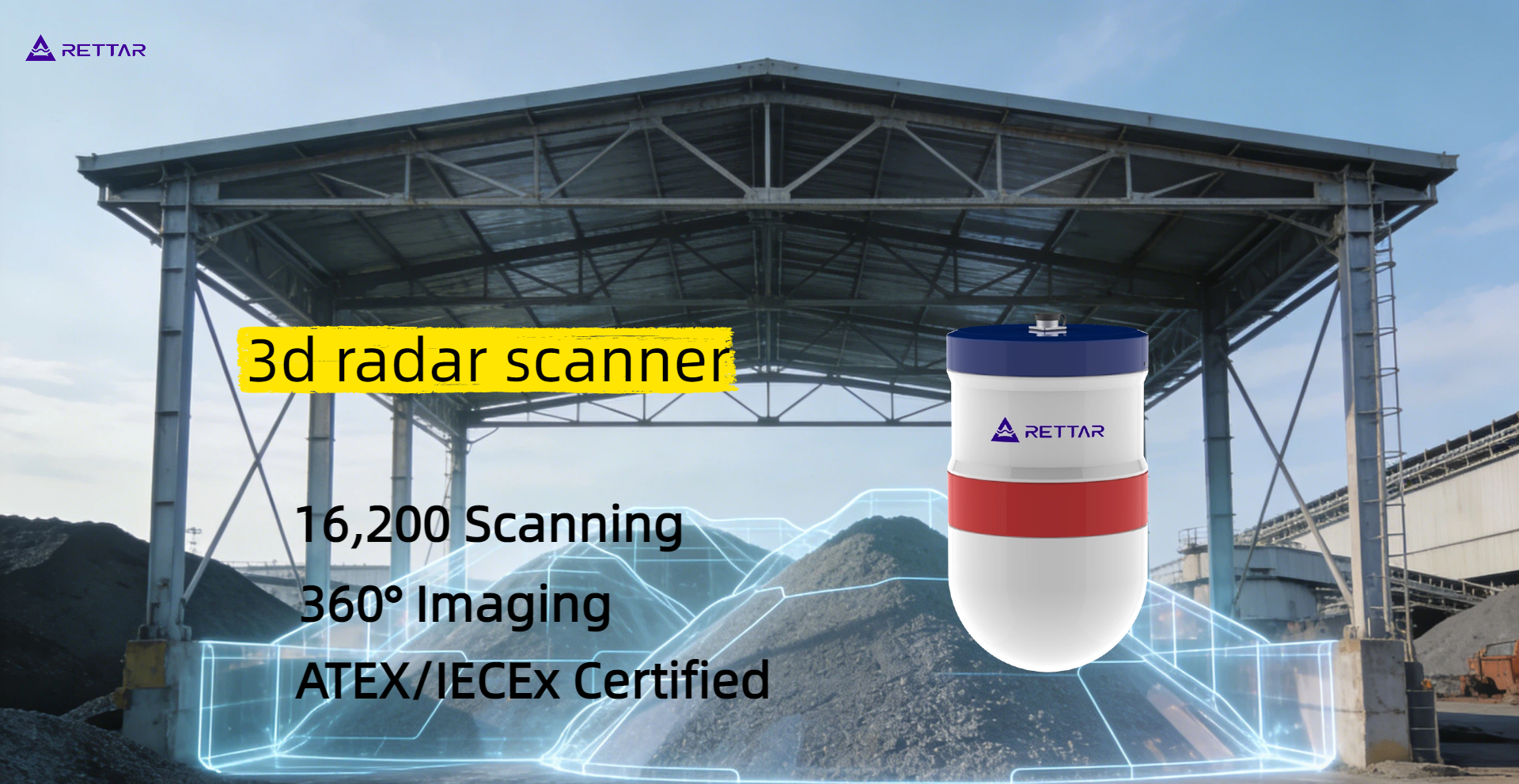
2. Full-Domain Scanning Mechanism: Horizontal 360° x Vertical ±90°
This scanning eliminates spatial blind spots. The 3D radar integrates a precision drive mechanism to achieve:
Horizontal: Continuous 360° rotation, covering the entire cross-section of the silo or stockpile.
Vertical: The vertical swing range of ±90° allows complete scanning from the top to the bottom of the silo. This nearly removes measurement blind spots.
3. Data Processing: High-Density Point Clouds and 3D Modeling
During the scan cycle, the device captures thousands to millions of data points. This helps create a dense spatial point cloud. This data is processed to render a 3D model of the actual material topography.
The software automatically spots and removes sidewall buildup. It also maps uneven material surfaces. This method delivers a volumetric measurement accuracy of up to 99%.
Operational Value: The Impact of Eliminating Blind Spots
1. Inventory Accuracy
Single-point measurements often lead to inventory differences of 10% to 30% because some areas are not measured. In contrast, a 3D radar level scanner reduces measurement error to ±0.5% to ±2% FS. This establishes a reliable baseline for financial auditing, procurement planning, and reconciliation.
2. Operational Efficiency
Reduces Unscheduled Downtime: Checking material levels in real-time stops delays from incorrect empty readings.
Optimizes Material Handling: Mapping material distribution helps automate scheduling for stacker-reclaimers. This boosts turnover rates.
Reduces Labor Costs: It cuts out manual sounding, rope drops, or physical checks. This lowers routine inspection workloads by more than 80%.
3. Safety and Compliance
Zero Personnel Exposure: Operators can monitor the 3D material profile from the control room, removing the need to enter hazardous environments.
Warning Indicators: The system detects issues including sidewall buildup and bridging and alerts operators accordingly..This reduces the risk of sudden collapses or overfills.
Explosion Compliance:The hardware has ATEX explosion-proof certification. This makes it safe for risky dust environments, like pulverized coal or grain storage.
The 3D radar level scanner offers full spatial visibility. It also tracks level and volume accurately. The system replaces the blind spots of traditional tools with clear data. This lets plant managers track the exact volume and distribution of bulk assets throughout the facility.
If your facility is suffering from inaccurate inventory data, material bridging, or faulty level readings, it is time to upgrade your monitoring infrastructure. Contact the RETTAR technical engineering team today to request a customized, field-proven 3D sensing blueprint tailored to your operational environment.